| The Canadian Directory of Water Towers and Standpipes is sponsored by "Understanding Your Home" |
|
Sault Ste. Marie - Northern Ontario
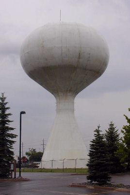
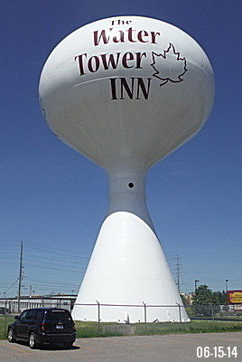
Algoma District. Photo © Mark Visser |
|

1969
|

2002
|

2014 |
Tower Information
Location: Second Line East, just east of Great Northern Road
Signage: Ault Ste. Marie. The water Tower Inn
Built: 1969 by Horton Steel Ltd. of Fort Erie, ON. Design: Proctor and Redfurn
Height: 31 meters.
Capacity: Photo credit: City of Sault Ste. Marie, (L and center), Mark Visser, (R)
The tower is not in use. The City sold it to the Algoma's Water Tower Inn located next to the tower |
|
|
|
|
Area information. Sault Ste. Marie is a city on the St. Marys River in Ontario close to the US–Canada border. It is the seat of the Algoma District and the third largest city in Northern Ontario, after Sudbury and Thunder Bay. To the south, across the river, is the United States and the city of Sault Ste. Marie, Michigan. These two communities were one city until a new treaty after the War of 1812 established the border between Canada and the United States in this area at the St. Mary's River. Shipping traffic in the Great Lakes system bypasses the Saint Mary's Rapids via the American Soo Locks, the world's busiest canal in terms of tonnage while smaller recreational and tour boats use the Canadian Sault Ste. Marie Canal.
In 1870, the United States refused to give the steamer Chicona, carrying Colonel Garnet Wolseley, permission to pass through the locks at Sault Ste Marie. In order to control their own water passage, the Canadians constructed the Sault Ste. Marie Canal, which was completed in 1895. Sault Ste. Marie, Ontario was incorporated as a town in 1887 and a city in 1912. Wikipedia |
|
|
Other sites you may be interested in
USA Water Towers and Standpipes
Magnetic Hills: USA, CA, Worldwide
Thumbnail Collection of USA Water Towers
The History of the Christian Fish Symbol |
|
|
|
| Home |
 |
Ontario - S Index |
|